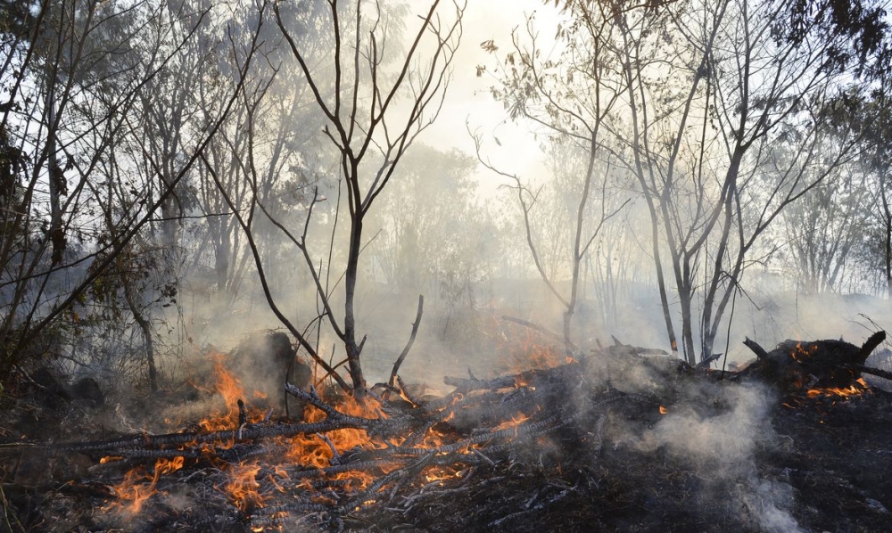


Photo: Valter Campanato/Agência Brasil
Published on 08/30/2023
By José Tadeu Arantes | Agência FAPESP – The Cerrado is the world’s most biodiverse savanna and home to 33% of Brazil’s biodiversity, but it is affected by the expansion of agriculture and is now severely endangered. Alongside an effective conservation policy, a crucial issue to be resolved is fire management. The Cerrado is the biome most affected by forest fires in all of South America, and these events are increasingly dangerous throughout the world owing to climate change, as evidenced by the disaster seen in Canada since June.
Brazilian researchers affiliated with the Federal University of Minas Gerais (UFMG) have developed an online system to predict wildfires, in partnership with colleagues at the University of Brasília (UnB), the Chico Mendes Institute for Biodiversity Conservation (ICMBio) and the National Space Research Institute (INPE). An article about the system is published in Scientific Reports.
“The system is the only one in the world capable of predicting the spread of a fire in quasi-real time. It uses remote sensing imagery combined with weather and topographical data to simulate wildfire propagation throughout the biome with up to 89% accuracy. Spatial resolution is 25 hectares in most of the biome and 0.4 ha in nine conservation units,” said Ubirajara Oliveira, first author of the article and a professor of graduate studies in environmental systems analysis and modeling at UFMG, where he is also a researcher in the Center for Remote Sensing.
The system simulates wildfire propagation in the Cerrado three times a day, Oliveira explained. “It’s automatically fed with data relating to ignition sources, fuel load [abundance of combustible matter], vegetation moisture and probability of burning,” he said. “No other global or regional initiative has so far offered a similar solution, especially in fully automated real-time propagation forecasting and high-resolution satellite imaging.”
Given a specified ignition source, the system predicts the direction of fire propagation, the duration of burning, the total area and amount of biomass that may be burned, and the resulting emissions of carbon dioxide (CO2). The model reflects weather conditions and the effects of several anthropogenic (human activity-related) factors, such as land zoning and the proximity of roads and urban areas.
Fire in the right measure
Like other savannas around the world, the Cerrado evolved in the presence of fire. Its plants have adapted to it. Many trees there are particularly hardy, as their trunks and branches are covered with a thick underbark layer of tissue made up of dead cells. Technically termed “suber tissue”, this epidermal layer is impregnated with suberin, a hydrophobic fatty substance. It acts as thermal insulation when an area burns, protecting the living tissue inside the plant. The suber burns, but the tree survives, and a new layer of suber grows back.
In the Cerrado’s herb layer, which comprises herbaceous or soft-stemmed plants such as grasses, ferns, brush and wildflowers, resilience comes mainly from roots and other underground reserve organs that store gemmae, from which plants resprout after fires die out.
Used preventively, intelligently and judiciously, with total area zoning and a rotating fire schedule, fire is indispensable to conservation and renovation of the Cerrado (read more at: agencia.fapesp.br/26064; agencia.fapesp.br/37940; agencia.fapesp.br/41100).
This contrasts with indiscriminate, often criminal, use of fire to eliminate native plants and prepare an area for cattle or crops. Proper fire management also differs from the wildfires fed by fuel loads that accumulate when several years go by without controlled burnings, so that the fire spreads swiftly, impairing the vegetation’s ability to regenerate and the survival of animals trapped amid the flames without an escape route. The fire propagation prediction system was developed to prevent such occurrences.
“It points to a way to optimize wildfire prevention and combat uncontrolled burning. The platform is already being used in day-to-day operations by the selected conservation units,” Oliveira said.
The system is not for use only in these conservation units but is available to anyone with internet access at: csr.ufmg.br/fipcerrado/en/. The platform is easy to use, enabling laypersons and the general public to interpret the statistics by viewing interactive maps and graphics.
“All this is possible thanks to the efficient processing of a vast amount of data using the software Dinamica EGO, also developed by UFMG’s Center for Remote Sensing,” Oliveira said.
The platform is known as FISC-Cerrado, where FISC stands for fire, ignition, spread and carbon cycling. It is part of a network of systems for prevention of forest fires and monitoring of plant cover in the Brazilian Cerrado and was developed under the auspices of the Forest Investment Program (FIP), a global initiative run by the World Bank with funding from a range of donors. The FIP aims to reduce deforestation and forest degradation while promoting sustainable forest management. Given the importance of the Cerrado and its vulnerability, the program chose this biome as its focus in Brazil.
The Cerrado is Brazil’s second-largest biome and home to some 12,000 species of plants and more than 2,500 species of animals, as well as the headwaters of South America’s three largest river basins. With an area of some 2 million square kilometers, it is present in 10 states (Maranhão, Piauí, Bahia, Tocantins, Goiás, Mato Grosso, Mato Grosso do Sul, Minas Gerais, São Paulo and Paraná) and the Federal District of Brasília.
Besides the FIP, the study received funding from several institutions, including FAPESP via the Thematic Project “Transition to sustainability and agriculture-energy-water nexus: exploring an integrated approach with case studies in the Cerrado and Caatinga”, led by Jean Ometto, a co-author of the Scientific Reports article.
The article “A near real-time web-system for predicting fire spread across the Cerrado biome” is at: www.nature.com/articles/s41598-023-30560-9.
A video explaining how the system works can be watched on YouTube.
Information on the network of systems for prevention of forest fires and monitoring of plant cover in the Brazilian Cerrado can be found at: csr.ufmg.br/fipcerrado/en/.
Source: https://agencia.fapesp.br/44694