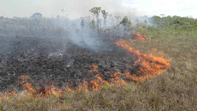
The researchers combined VOD, an indicator of the amount of water in vegetation, with remote sensing data from optical satellites. The innovative strategy described in Remote Sensing provides a more comprehensive understanding of the biomass changes caused by fire (photo: Prevfogo/IBAMA)
Published on 08/30/2021
By Luciana Constantino | Agência FAPESP – Understanding the impact of the damage done by frequent forest fires in the Amazon, the world’s largest and most biodiverse tropical forest, has been a challenge in recent years. A promising tool now available to aid this effort, according to an article published in the journal Remote Sensing, is a type of satellite-based remote sensing called vegetation optical depth (VOD), which provides scientifically consistent data for use in analyzing vegetation changes due to fire.
Passive microwave-based VOD indicates vegetation attenuation and soil moisture, which correlate linearly with vegetation water content (density) and above-ground biomass (leaves and wood), and can be interpreted as evidence of canopy dryness due to weather or burning. Microwave radar is less influenced by atmospheric conditions and clouds than optical satellites, which use reflected light to detect electromagnetic energy on the Earth’s surface.
The canopy plays an important role in forest dynamics because it is a rich habitat for plants and animals, constituting a different environment from the understory, herb floor and other lower layers.
The study, reported in a special issue of the journal focusing on applications of remote sensing and VOD, was conducted by researchers at Nanjing University in China, with the collaboration of Brazilian scientist Ricardo Dal’Agnol. The authors conclude that VOD combined with optical indices can provide comprehensive real-time information on vegetation changes caused by fire, and should be applied widely in the future.
“This was the first test of VOD data to analyze the effects of fire on canopy dynamics in the Amazon Rainforest,” said Dal’Agnol, a researcher in the Earth Observation and Geoinformatics Division of the National Space Research Institute (INPE) whose work is supported by a postdoctoral fellowship from FAPESP.
The study used VOD data for an area in the southern Amazon collected during the fire season, in July-October 2019, as well as three types of optical data: normalized difference vegetation index (NDVI), enhanced vegetation index (EVI), and normalized burn ratio (NBR).
The authors say they found rainfall to be very close to the average for the period, suggesting that there were no extreme events and that fire was the main factor that caused anomalies in the forest canopy. The number of active fires calculated for each month during the 2019 fire season was above average, particularly in August and September.
Cross-referencing of anomalies in the VOD and optical data with the spatiotemporal distribution of fires in the period showed that VOD offered a more accurate picture of the dynamics of photosynthetic and non-photosynthetic biomass (leaves and branches respectively).
In August and September, however, the optical indices pointed to larger losses than the VOD data, with much faster recovery than in areas with relatively little fire activity.
For the authors, the reason for the discrepancy is probably that VOD represents the dynamics of the entire tree, while optical data focuses on leaves, which recover more quickly. It may also reflect the different canopy properties captured by the indices: NDVI is sensitive to chlorophyll and photosynthetic biomass, for example, while NBR detects areas of bare ground resulting from vegetation changes.
Impacts
The Amazon plays a key role in the global carbon cycle thanks to its huge carbon dioxide absorption capacity, but the balance of carbon uptake and emissions has changed in recent years owing to the increase in deforestation associated with fire, drought and other climate events.
Fire leads to significant changes in the forest’s vegetation, ecosystems and species composition, boosts carbon emissions, and affects the climate on a regional and global scale. Extreme weather events are expected to become more frequent and severe as temperatures in the Amazon steadily rise in the decades ahead, and a better grasp of the impacts of fire on vegetation dynamics is crucial to assessments of carbon emissions both there and worldwide.
Data published late last year by MapBiomas Fogo, a platform that offers information on fire and land use from 2000, shows that more than 330,000 square kilometers of forest in Brazil burned down in the last 20 years, with the Amazon accounting for 28.7% of the total. Half of the 427,000 sq. km. affected burned down more than once in the same place. Not long ago, fire was a rarity in the Amazon.
INPE reported 89,176 fires in 2019, the year on which the study focuses, and in 2020 the number increased to 103,161. This was the third-highest number ever, behind only 2015 and 2017.
According to an innovative study published in May by another group of researchers that also included Dal’Agnol, burned forest loses 27.3% of its stem density on average, even in wet areas of the Amazon. The destruction affects mainly trees of small and medium size. Loss of biomass (stored carbon) in the three years following a fire reaches 12.8%.
The researchers analyzed burned and unburned areas immediately after the fires that swept through the north of the area between the Purus and Madeira Rivers (central Amazon) in 2015 and conducted annual surveys to track the demographic drivers of biomass change in the ensuing three years (more at: agencia.fapesp.br/36601/).
Results
The authors of the Remote Sensing article note that the temporal pattern of canopy changes indicated by the VOD and optical data was similar only in areas with fire activities. “The magnitude of canopy damage increased with the rising fire occurrences from July to September. In October, with fires decreasing or stopping, the canopy showed signs of recovery in areas with fewer fires, while canopy restoration in severe fire areas had not yet begun,” they conclude.
The article “Forest canopy changes in the southern Amazon during the 2019 fire season based on passive microwave and optical satellite observations” is at: www.mdpi.com/2072-4292/13/12/2238/htm.
Source: https://agencia.fapesp.br/36726
